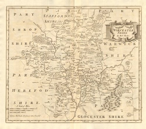
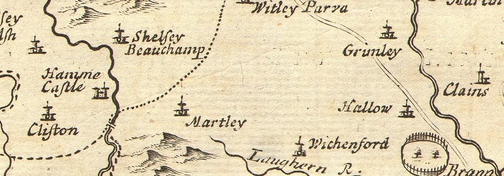
Antique Map: WORCESTERSHIRE. by ROBERT MORDEN from Camden's Britannia. Title: 'Worcester shire'. Type: Double page folio copperplate engraved map. Date of printing: 1772. Size: 40.0 x 45.5cm, 15.75 x 17.75 inches (Large); Please note that this is a folding map., 1834 sq cm. This item is folding. Artist, cartographer or engraver: Robert Morden; "Sold by Abel Swale Awnsham & Iohn Churchil [John Churchill]".. Condition: Good; suitable for framing. However, please note: The image shown may have been taken from a different example of this map than that which is offered for sale. The map you will receive is in good condition but there may be minor variations in the condition from that shown in the image. Please check the scan for any blemishes prior to making your purchase. Verso: There is nothing printed on the reverse side, which is plain. Provenance: [Camden's Britannia] - scarce 4th Gibson edition, 1772. "Britannia, or a Chorographical Description of Great Britain and Ireland, together with the adjacent islands", written in Latin by William Camden, Clarenceux King at Arms, and translated into English, with additions and improvements by Edmund Gibson, DD, late Lord Bishop of London. MDCCLXXII. "Britannia", one of the best known 17th and 18th century atlases of the British Isles, was originally published in Latin in 1586 by William Camden. Four editions of the atlas translated by Gibson were published in 1695, 1722, 1753 and 1772, each accompanied by the highly regarded maps of Robert Morden. The 3rd and 4th are the scarcer of the Gibson editions, and do not suffer the thin, brittle paper on which the 1st edition maps were published. Subject categories: Worcestershire Morden.
Trustpilot
4 days ago
1 week ago
