

Mount Rainier National Park Map (National Geographic Trails Illustrated Map, 217)
R**S
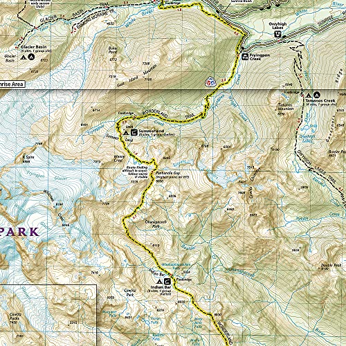
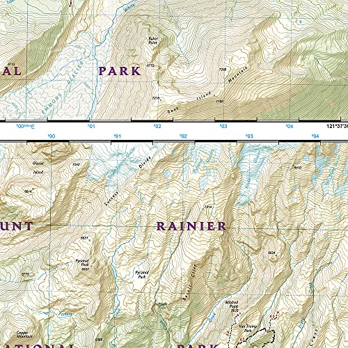
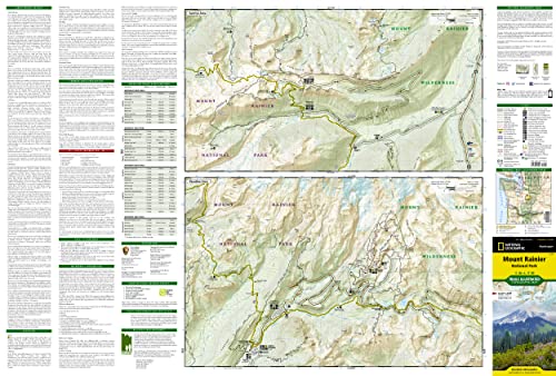
Thorough topographical map
This map is a must for planning and supplementing apps. Water and tear resistant. If one of these maps are available for my upcoming hike, I buy it.
L**S
Excellent
I love these maps. Accurate and used all the time to plan my backpacking trips!
P**K
Could use a few more marked trails
Missing a lot of trails. But overall a good map
T**R
Detailed!
Planning a trip soon! Map is great!
N**L
Only Map you need for Wonderland Trail and Mount Rainier Region
NG maps of US national parks are hit and miss but this one is a big HIT. If you are hiking around Mount Rainier and especially Wonderland trail or North section of Rainier, this map is for you. Lots of details - Campground info, highlighted wonderland trail, trail intersections are what you need to know while planning. I wish other NG maps are drawn like this.
C**R
The map is great in it's detail and its durability, but it's no better than the free one they'll give you at the park
The map is great in it's detail and its durability, but it's not really any better than the free one they'll give you at the parks entrance.When I went to Bryce Canyon and Zion Nation Parks last year, I bought the National Geographic maps ahead of time and they helped me plan out the hikes to do at each. Both of those maps had pretty good descriptions for most of the hiking trails (length, height, level of difficulty, condition/type of trail, what to expect to see, time you should expect to take.) We were able to plan ahead which trails to take, which 2 could be done in the same day, and in what order to do them in. It was great.So, when we were planning out next hiking trip (that included going to Redwood, Mount Rainier, Olympic, Crater Lake, and Mount St. Helen), we immediately ordered this map to help us plan. This time around we had to not only figure out what trails to do in each park but compare the trails of all the parks to help us figure out how to split 2 weeks between 5 parks. We thought that all the maps would have the same info for the hiking trails as Zion & Bryce Canyon had. They don't. This map was useless for the purpose we wanted it. Instead of getting the info from a single reliable source, we had to trust to the internet. This didn't help much. Though there are a lot of posting about the trails, they're all very opinionated instead of factual. They described how beautiful the trail was, but would leave off the trail's length, height, level of difficulty, condition/type of trail, what to expect to see, or time it should take.So if you're looking for hiking info, don't get this map. Just wait until you get there and go right to the info station and talk with a park ranger. It doesn't help planning ahead of time, but it's a lot better than taking the internet's advice.
J**G
... that I am planning on traveling to and I love them. They help me to find hiking locations ...
I get these National Geographic maps for any location that I am planning on traveling to and I love them. They help me to find hiking locations and sights that I may want to visit.
A**R
Fantastic map!
This map is well made and likely to survive some dampness in the woods for awhile. The trails are well marked. Worth having
M**N
Excellent Map
This is an excellent map for visiting the park, it show roads and hiking trails in details. It is in colour and has been very useful in planning our trip .
B**E
Sehr informativ und hilfreich.
Die Karte ist sehr genau. Da wir mit einem großen Wohnmobil durch die USA und Kanada fahren, wollten wir vorab wissen, welche Strecken und Campingplätze, für unser Wohnmobil geeignet sind. In den Karten ist genau vermerkt, wo Campingplätze, Rastplätze, Besucherzentren usw. zu finden sind. Außerdem sind jede Menge Wanderwege eingezeichnet, so das man sich jederzeit auf den Weg machen kann. Die Erklärungen bzw. Legenden sind zwar in Englisch, sind aber trotzdem leicht verständlich. Wir können die Karte nur empfehlen.
M**S
Gute Karte
Eine gute Karte für Wanderungen
J**E
Four Stars
Good map in good condition
度**度
耐水紙なのでgood
マウントレーニア国立公園内のトレッキングに利用しました。山と高原地図のように耐水紙仕様なので、安心して使えます。普通の紙だと、雨天での使用でなくても使っていくうちにボロボロになることがありますが、こちらの商品はそのようなことはありません。
Trustpilot
3 weeks ago
1 month ago