Description
- About this item
- Map Size: 1 foot x 2 feet (60.96cm x 30.48cm) | Ready to frame in standard size frame (12x24) |Frame not included
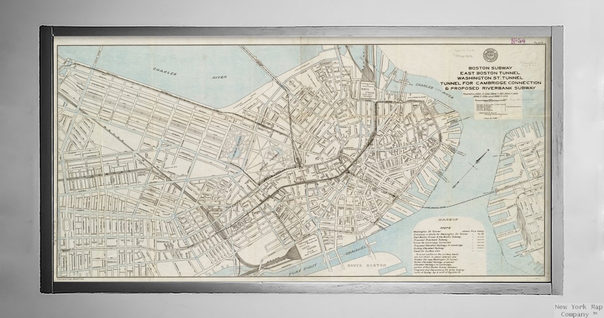
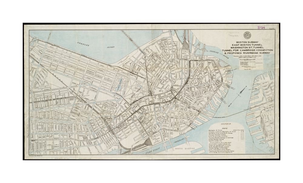
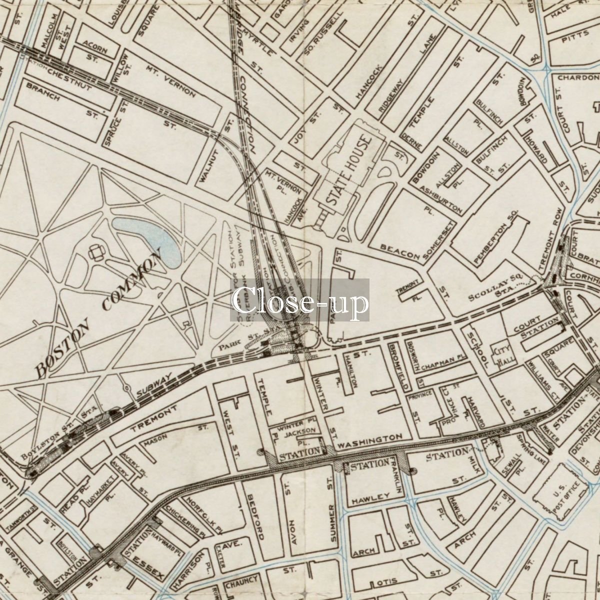
- 1910 Map Boston Boston Subway, East Boston Tunnel, Washington St. Tunnel, tunnel for Cambridge connection & proposed Riverbank Subway Oriented with north toward the upper right. Cut from the 16th annual report of the Boston Transit Commission. In upper right margin: Plate 1. In lower left margin: Cockayne, Boston.
- Massachusetts > Suffolk (county) > Boston| Notes: Oriented with north toward the upper right. Cut from the 16th annual report of the Boston Transit Commission. In upper right margin: Plate 1. In lower left margin: Cockayne, Boston.Subjects: Subways--Massachusetts--Boston--Maps| Boston (Mass.)--Maps
- Each map is hand printed in our studio | Quality & Satisfaction Guaranteed | Made in the USA
- This giclée print is produced on thick Fine Art Semi Matte Paper (Weight: 235 g/m2, Thickness: 10 mil, ISO brightness: 95%) and coated with a satin finish that maintains vivid colors and faithfulness to the original map. Your giclée print is Archival Quality and guaranteed not to fade for 200+ years.
1910 Map Boston Boston Subway, East Boston Tunnel, Washington St. Tunnel, tunnel for Cambridge connection & proposed Riverbank Subway Oriented with north toward the upper right. Cut from the 16th annual report of the Boston Transit Commission. In upper right margin: Plate 1. In lower left margin: Cockayne, Boston.