
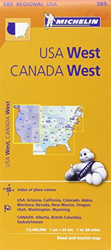


Michelin USA: West, Canada: West Map 585 (Maps/Regional (Michelin))
T**O
Scale is the same as the northeast Michelin map
Using this map to collaborate and plan a road trip with my family. I purchased both the northwest and northeast Michelin road maps and attached them to the wall.
M**B
Huge but well designed map
In this day and age of everything-digital, it's funny how, sometimes, the old standards still shine. I still print some excel files, I want a paper recipe in front of me and damn, sometimes, planning road trips CANNOT be done properly on Google Maps. Don't get me wrong, I love the digital conveniences of our times, but they're not the be-all and end-all.This paper map from Michelin is a great example of why paper maps still exist. It does a terrific job of showing possible places along the way of a long road trip where we might stop for the night, grab a meal and a bed and start out the next day. It is far easier to see these possible places on a paper map that it is on line. The Michelin map is filled with details, shows towns and cities just slightly off our main intended route and is practically a work of art. My only minor complaint is that this baby is huge - you will NOT fully open this map while driving. Fortunately, it folds in such a way that you can open it partially to just the portion you need to see.I have not compared this map to other detailed maps from other vendors, so I can't tell you if it will be your best bet. It does not feature hotels or offer discounts at theme parks, but I didn't buy this map to get 15% off the Largest Ball of Twine Museum.
R**A
Good map! Good for big picture view!
I wanted a big map, this is a good one. But if you are looking for secondary roads and details it might not be the right choice for you.
C**E
SCORE Single-sided map of the Western US!
Compared several folded maps on Amazon, saw zero examples of unfolded maps (uh what? why?), saw zero reviews with useful photos...uh what? I bought an atlas knowing it at least had all the states, but I also wanted a detail view of the Western US, printed on one single page so I can paste it to the wall. Something budget-friendly. I took a chance and bought this map without seeing it first. THIS IS IT. SUCCESS. See my photo! My requirements were: clear state lines, one-sided print, major states in their entirety, Western US region, major roads, some indication of landscape. This Michelin map met all of my needs.
E**S
Indispensible Road Tripper
Outstanding map - like all Michelin maps, the most trustworthy maps in the world. When my Father and I were adventuring in Africa, we used Michelin maps, and now when I'm navigating out here in the American South West, I use a Michelin map - they are simply unrivaled for quality, craftsmanship and accuracy. This particular one is especially useful because it covers the 11 westernmost USA states completely, and southwestern Alberta, British Columbia, and Saskatchewan, making it possible to do an awful lot of voyage planning on one chart. For example: it captures ALL of the Sierra; not just the Sierra in California, or just in Nevada; it encompasses all of Vancouver Island and approaches from Canada, and the United States. It is especially useful for discovering State and secondary roads that connect interstates via interesting byways through the hinterland of this beautiful country of ours.
G**R
Alaska part of US, Yukon part of Canada
Map of western lower 48 US, and a bit of southwest Canada. It lacks all of Alaska and quite a bit of western Canada.Quite a disappointment as I was driving through much of the area not covered, and indeed this is the part we’re a map was more essential as it was often out of cell phone/data range, and was not a straight shot on interstate like more southern parts of western US and Canada.
B**H
A Very Useful Large Detailed Map
We are taking a long driving trip through many of the states of the West. We're very familiar with most of these states area and wanted a map that combined showing all the states with a significant amount of detail. As other reviewers have mentioned, it folds out to a very large size which would make it difficult to use in the car, but is excellent for route planning. When combined with state maps and possibly maps covering fewer states such as Michelin's map of the Four Corners state (Arizona, New Mexico, Colorado and Utah) you should be able to easily plan your trips.
S**S
No Scenic Routes Marked
I ordered the map because at least one other reviewer indicated it had scenic routes on it. To me that means those routes are marked with small dots for the length of the scenic distance. The map is nice and does have most all of the small secondary roads indicated, but there is no indication of what routes are scenic. National Geographic sells a map that is marked with scenic routes but the last publication of it was about ten years back, I am waiting for them to come out with a more current version of their map. In the mean time I am reluctantly keeping the Michelin map because I do at times want to know about all the little roads out there. Some other reviewers indicated the map is large, yes it is unwieldy. It is like 2X bigger than a AAA map. Unfolded it measures 39 X 47". Your not going to be able open it inside a passenger car. I wonder why they didn't make it half its size and print on both sides instead of just one. If you like a map that you can spread out on a large table this map will work well for you.
M**E
Perfect for planning.
Huge map, great for planning our journey. Too big to take with us.
T**N
Very Basic
As a couple of others have said, this is a very basic map with little or no detail of anything much other than interstates and highways.
D**.
The Michelin Map-Don't Travel Without It!
Even with GPS and online travel guides I still find that the "old fashioned map" is very useful for scoping out the day's travel mileage ahead .At a glance I can take note of a variety of different places such as where we might stop for the night and where the next town is if we want to "press on" before nightfall. With my Michelin USA travel map decisions about the trip can be made just like that.
G**O
Compagna di viaggio
Mi ha fatto compagnia durante il viaggio; la scala è sufficiente per individuare le strade di interesse. Comprende una vasta area, così da evitare l'acquisto di più carte. Ovviamente, se si è interessati a tutte le stradine secondarie, serve una mappa più dettagliata. Tutto dipende, ovviamente, dalle esigenze. Per le mie questa è andata benissimo.
R**T
It's OK for the money
It's paper and it will deteriorate over time. But that's OK; maps need to be updated anyhow.
Trustpilot
3 weeks ago
1 day ago